↓ Skip to Main Content
Oplopanax Horridus

Oplopanax Horridus

A veteran SAR volunteer's experiences in British Columbia

Main Navigation

  • About
    • About Me
    • Copyright
    • Privacy Policy
    • Commenting policy
    • Disclaimer
    • Why Oplopanax
  • Popular
    • On Blaming the Victim
    • How to Kill Yourself Snowshoeing
    • Smart Phones and Battery Life
    • Don’t use Smart Phones for Backcountry Navigation
    • PLBs from the Rescuer’s Perspective
    • Finding Someone from a Helicopter
    • On Coordinates
    • A Social Media Storm
  • Projects
    • TrueNorth Geospatial
    • Missing Poster Generator
    • YourLo.ca/tion
    • SAR Teams Map
    • Range Rings
  • SAR Links
    • BC SAR Teams
    • SAR Agencies
  • Media
  • Contact
Home › Posts tagged satellite

Tag: satellite

Accidental Triggering of SPOT device

By Michael Coyle Posted on 25/09/2017 Posted in Blog Entry 5 Comments Tagged with SAR, satellite, SEND, SPOT, technology
Accidental Triggering of SPOT device
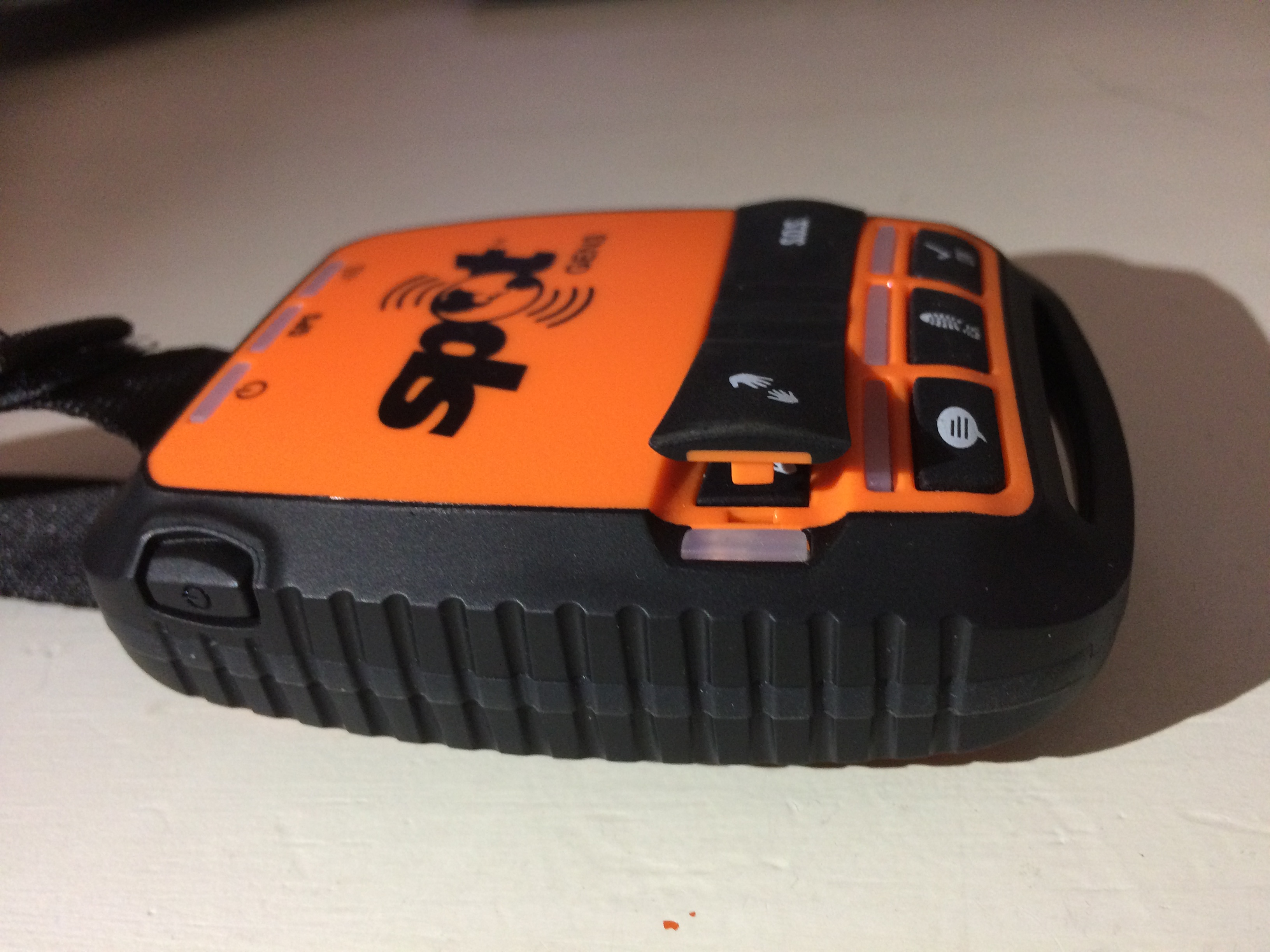
Another view of malfunctioning button cover.

Accidental trigger of a SPOT device, general discussion of devices limitations, and how to avoid them.

Read more ›

“Malfunctioning” Satellite messengers

By Michael Coyle Posted on 25/01/2016 Posted in Blog Entry 11 Comments Tagged with satellite, SEND, tech, technology
“Malfunctioning” Satellite messengers

In the past year I’ve heard of two situations where the improper use of a satellite emergency notification device (SEND) such as an DeLorme InReach or SPOT Messenger have caused SAR to be called out to search. In both cases I suspect user …

“Malfunctioning” Satellite messengers Read more »

Satellite Phones and 911

By Michael Coyle Posted on 19/03/2012 Posted in Blog Entry 1 Comment Tagged with communications, emergency, rescue, satellite, tech, technology

Satellite Phones may not have 911 capability; users should know what number to call for rescue

BlueToque Software
BlueToque Software
My software company
Software Design, Architecture and Consulting

TrueNorth Geospatial
The mapping software I designed for SAR
Mapping Software for Backcountry Professionals

YourLo.ca/tion
YourLo.ca/tion
Locate people using their SmartPhones

Buy a T-Shirt

Recent

  • Backcountry Safety is a Shared Responsibility
  • Are “selfies” hazardous?
  • “Dog Walker” Behaviour Profile
  • Reflections on 2017
  • Accidental Triggering of SPOT device

Tags

accident avalanche backcountry climbing communications death dementia emergency funding gear GPS grim helicopter HETS how-to InfoSAR Logan 2011 management map meta news numbers olympics opinion rant rescue review risk safety SAR SARDay search ski smart phone SMS snow snowshoe social media tech technology training Tyler Wright UAV video weather

Blogroll

  • AdventureSmart
  • Coquitlam SAR
  • North Shore Hikers
  • North Shore Outdoor
  • Outdoor Vancouver
  • Roland Web Memorial
  • SARBayes
  • TrueNorth Geospatial
  • Wayne Flann's Avalanche Blog

Older stuff

Recent

  • Backcountry Safety is a Shared Responsibility
  • Are “selfies” hazardous?
  • “Dog Walker” Behaviour Profile
  • Reflections on 2017
  • Accidental Triggering of SPOT device

Blogroll

  • AdventureSmart
  • Coquitlam SAR
  • North Shore Hikers
  • North Shore Outdoor
  • Outdoor Vancouver
  • Roland Web Memorial
  • SARBayes
  • TrueNorth Geospatial
  • Wayne Flann's Avalanche Blog

Projects

  • BlueToque Software
  • Missing Poster Generator
  • TrueNorth Geospatial
  • YourLo.ca/tion

Resource

  • AdventureSmart
  • Canadian Avalanche Association
  • Canadian Avalanche Centre
  • TrueNorth Geospatial

Projects

  • BlueToque Software Software architecture, design and build BlueToque Software Software architecture, design and build
  • Missing Poster Generator Easy generation, printing and sharing of missing posters Missing Poster Generator Easy generation, printing and sharing of missing posters
  • TrueNorth Geospatial Mapping software for backcountry professionals TrueNorth Geospatial Mapping software for backcountry professionals
  • YourLo.ca/tion A simple location finding, sharing and tracking service for SAR teams YourLo.ca/tion A simple location finding, sharing and tracking service for SAR teams
Creative Commons Licence
Oplopanax Horridus Copyright © 2013 by Michael Coyle
All content, except where otherwise noted, is licensed under a Creative Commons Attribution-NonCommercial-ShareAlike 2.5 Canada License.
Read about what that means, and contact the author for commercial licenses if necessary.

Footer Menu

  • Copyright
  • Disclaimer
  • Privacy Policy
  • Why Oplopanax
© 2023 © 2023 Oplopanax Horridus | Powered by Responsive Theme