↓ Skip to Main Content
Oplopanax Horridus

Oplopanax Horridus

A veteran SAR volunteer's experiences in British Columbia

Follow Us on FacebookFollow Us on TwitterFollow Us on LinkedInFollow Us on YouTubeFollow Us on RSSFollow Us on StackOverflow

Main Navigation

  • About
    • About Me
    • Copyright
    • Privacy Policy
    • Commenting policy
    • Disclaimer
    • Why Oplopanax
  • Popular
    • On Blaming the Victim
    • How to Kill Yourself Snowshoeing
    • Smart Phones and Battery Life
    • Don’t use Smart Phones for Backcountry Navigation
    • PLBs from the Rescuer’s Perspective
    • Finding Someone from a Helicopter
    • On Coordinates
    • A Social Media Storm
  • Projects
    • TrueNorth Geospatial
    • Missing Poster Generator
    • YourLo.ca/tion
    • SAR Teams Map
    • Range Rings
  • SAR Links
    • BC SAR Teams
    • SAR Agencies
  • Media
  • Contact
Home › Posts tagged map › Page 2

Tag: map

Personal Locator Beacons from the Rescuer’s Perspective

By Michael Coyle Posted on 26/08/2011 Posted in Blog Entry, Essay 14 Comments Tagged with backcountry, beacon, case study, helicopters, HETS, management, map, personal locator beacon, PLB, rescue, safety, Tyler Wright, weather
Personal Locator Beacons from the Rescuer’s Perspective

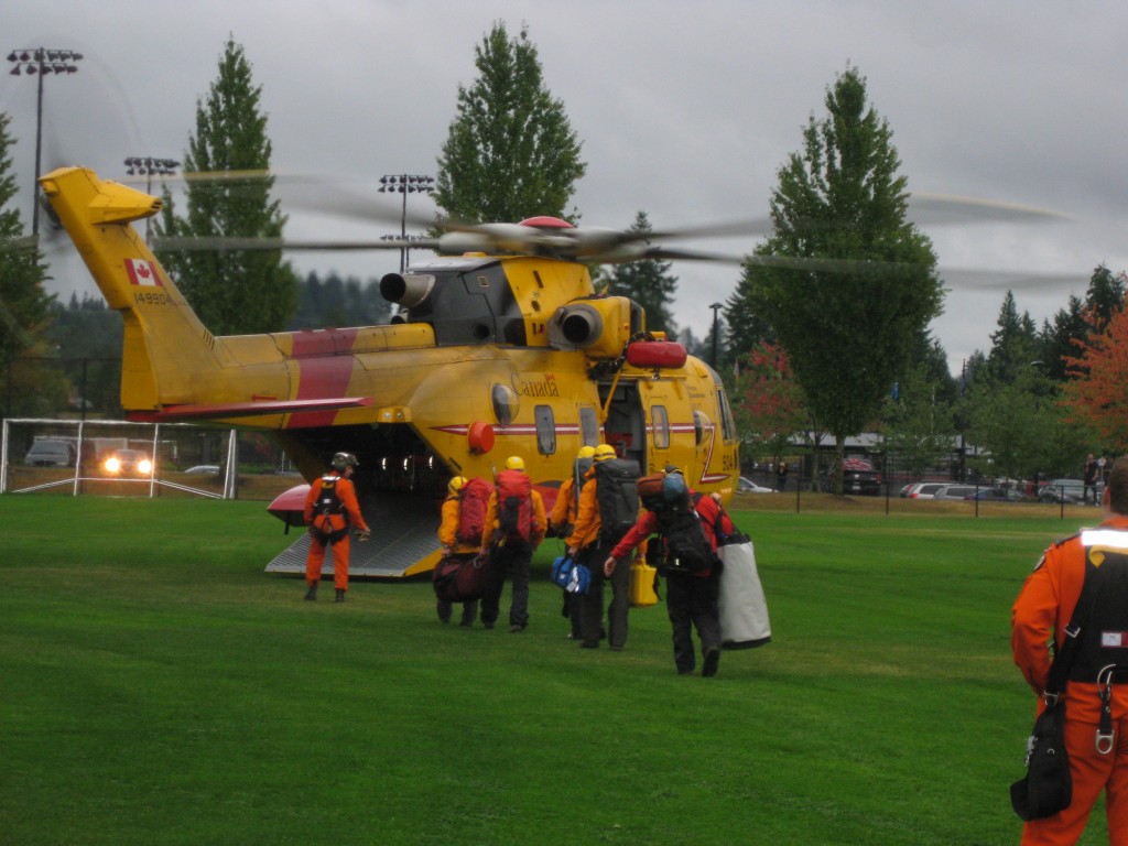
A case study of a rescue with a Personal Locator Beacon in SouthWestern BC detailing rescuer’s difficulties accessing the location.

Why you shouldn’t use Smart Phones for Backcountry Navigation

By Michael Coyle Posted on 23/05/2011 Posted in Blog Entry, Essay 15 Comments Tagged with communications, gear, GPS, how-to, map, smart phone, technology
Why you shouldn’t use Smart Phones for Backcountry Navigation

Smart phones are problematic for backcountry navigation; they are fagile, have terrible battery life, and are less accurate than a wilderness GPS unit.

On Coordinates; part 2

By Michael Coyle Posted on 09/02/2011 Posted in Blog Entry No Comments Tagged with backcountry, gear, GPS, map, SAR, technology
On Coordinates; part 2
GPS Track of helicopter flight into the Pitt River area.

In my previous post on coordinates, I stated that the best coordinate representation to use if you need to use geographic coordinates (latitude and longitude) was decimal degrees (or DD). It’s preferable to use UTM, which is pretty much a …

On Coordinates; part 2 Read more »

On Coordinates

By Michael Coyle Posted on 02/02/2011 Posted in Blog Entry 5 Comments Tagged with backcountry, gear, GPS, map, SAR, smart phone, technology
On Coordinates
SAR Member using a map

An article about recording and transmitting geographic coordinates accurately.

Maps vs. Air Photos

By Michael Coyle Posted on 02/05/2010 Posted in Blog Entry 4 Comments Tagged with how-to, map, opinion

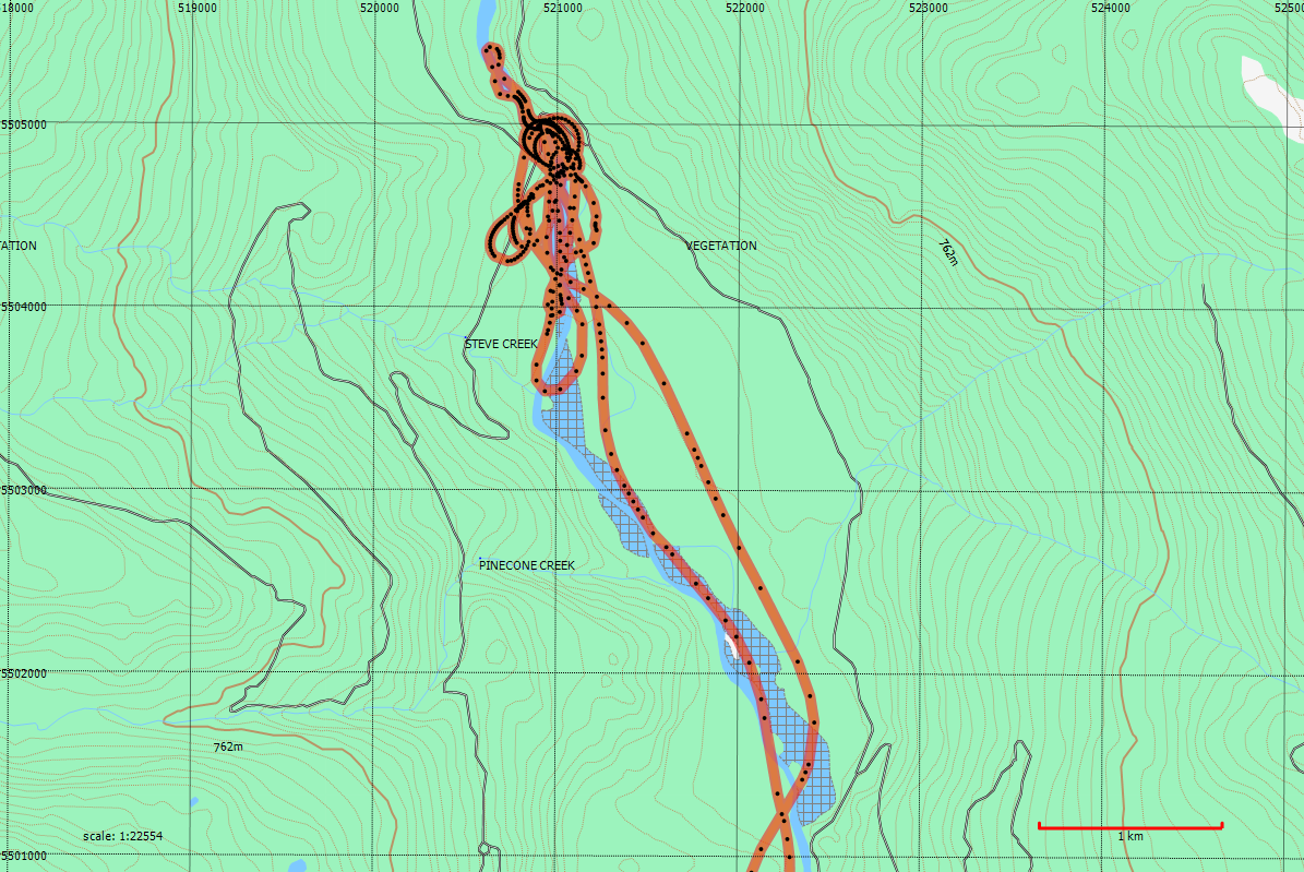
Now that everyone with an internet connection has access to Google Earth and Google Maps, we all have access to some fairly high quality air photo imagery. This might seem to be a good thing, but there are problems with …

Maps vs. Air Photos Read more »

GPS vs. Paper Maps

By Michael Coyle Posted on 14/04/2010 Posted in Blog Entry No Comments Tagged with GPS, map, navigation, opinion, technology
GPS vs. Paper Maps

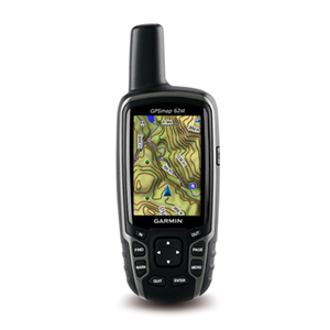
Ever since I saw my  first mapping GPS I’ve been pretty critical of them (well, those that know me know I’m pretty critical about everything). To be clear I’m not critical about the basic utility of plotting your position on …

GPS vs. Paper Maps Read more »

SAR Day 8: GPS Navigation

By Michael Coyle Posted on 10/04/2010 Posted in Blog Entry, SAR Day No Comments Tagged with GPS, how-to, map, navigation, SAR, SARDay, training
SAR Day 8: GPS Navigation

GPS Navigation training

SAR Day 6: Navigation part 2

By Michael Coyle Posted on 24/03/2010 Posted in Blog Entry, SAR Day No Comments Tagged with GPS, map, navigation, SAR, SARDay, training
SAR Day 6: Navigation part 2

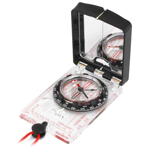
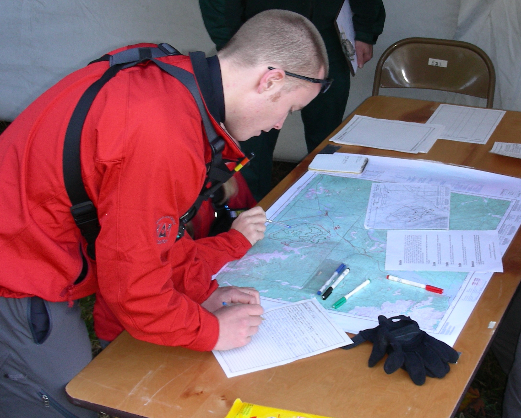
Regular training day with navigation on the schedule. Map and compass. In the past 10 years, the biggest errors in navigation I’ve seen have all been variations on transcription errors. What happens is this: people will report their position using …

SAR Day 6: Navigation part 2 Read more »

Cell phone locations

By Michael Coyle Posted on 27/09/2009 Posted in Blog Entry No Comments Tagged with communications, GPS, map, SAR, technology
Cell phone locations

The SAR team has had a run of searches at inopportune times. The first one was after an all night search, so we rolled from the first search, into breakfast …

Excercise SILVER

By Michael Coyle Posted on 13/02/2009 Posted in Blog Entry No Comments Tagged with management, map, scenario, software, training

An Earthquake near Tsawwassen, a structure fire on Hamilton Street, a gas leak at Robson and Cambie, and a dirty bomb in Agasiz. Just another day in Excercise Silver. Silver, the second in the series of preperatory emergency excercises leading …

Excercise SILVER Read more »

Posts navigation

Previous 1 2
BlueToque Software
BlueToque Software
My software company
Software Design, Architecture and Consulting

TrueNorth Geospatial
The mapping software I designed for SAR
Mapping Software for Backcountry Professionals

YourLo.ca/tion
YourLo.ca/tion
Locate people using their SmartPhones

Buy a T-Shirt

Recent

  • Backcountry Safety is a Shared Responsibility
  • Are “selfies” hazardous?
  • “Dog Walker” Behaviour Profile
  • Reflections on 2017
  • Accidental Triggering of SPOT device

Tags

accident avalanche backcountry climbing communications death dementia emergency funding gear GPS grim helicopter HETS how-to InfoSAR Logan 2011 management map meta news numbers olympics opinion rant rescue review risk safety SAR SARDay search ski smart phone SMS snow snowshoe social media tech technology training Tyler Wright UAV video weather

Blogroll

  • AdventureSmart
  • Coquitlam SAR
  • North Shore Hikers
  • North Shore Outdoor
  • Outdoor Vancouver
  • Roland Web Memorial
  • SARBayes
  • TrueNorth Geospatial
  • Wayne Flann's Avalanche Blog

Older stuff

Recent

  • Backcountry Safety is a Shared Responsibility
  • Are “selfies” hazardous?
  • “Dog Walker” Behaviour Profile
  • Reflections on 2017
  • Accidental Triggering of SPOT device

Blogroll

  • AdventureSmart
  • Coquitlam SAR
  • North Shore Hikers
  • North Shore Outdoor
  • Outdoor Vancouver
  • Roland Web Memorial
  • SARBayes
  • TrueNorth Geospatial
  • Wayne Flann's Avalanche Blog

Projects

  • BlueToque Software
  • Missing Poster Generator
  • TrueNorth Geospatial
  • YourLo.ca/tion

Resource

  • AdventureSmart
  • Canadian Avalanche Association
  • Canadian Avalanche Centre
  • TrueNorth Geospatial

Projects

  • BlueToque Software Software architecture, design and build BlueToque Software Software architecture, design and build
  • Missing Poster Generator Easy generation, printing and sharing of missing posters Missing Poster Generator Easy generation, printing and sharing of missing posters
  • TrueNorth Geospatial Mapping software for backcountry professionals TrueNorth Geospatial Mapping software for backcountry professionals
  • YourLo.ca/tion A simple location finding, sharing and tracking service for SAR teams YourLo.ca/tion A simple location finding, sharing and tracking service for SAR teams
Creative Commons Licence
Oplopanax Horridus Copyright © 2013 by Michael Coyle
All content, except where otherwise noted, is licensed under a Creative Commons Attribution-NonCommercial-ShareAlike 2.5 Canada License.
Read about what that means, and contact the author for commercial licenses if necessary.

Footer Menu

  • Copyright
  • Disclaimer
  • Privacy Policy
  • Why Oplopanax
© 2023 © 2023 Oplopanax Horridus | Powered by Responsive Theme