
On Coordinates
A while back I wrote about some issues I’ve witnessed with backcountry enthusiasts, SAR people, and geographic coordinates. In my experience, people have trouble recording and transmitting coordinates. This should be a very simple task, and it is – when you use the right notation. In this post I describe the problems with using various coordinate systems, show how some of them are not well suited for recording or transmission, show several notations for latitude and longitude, and make some recommendations for the best formats to use.
There are two coordinate systems in common use in Canada: UTM and Geographic latitude and longitude (aka lat/lon).
UTM is used by most serious backcountry enthusiasts because it uses familiar units such as kilometres and meters, is useful on a scale and speed of backcountry travel, and it is clearly printed on the National Topographic series of maps which have been in use for many years. I recommend everyone use UTM as much as possible. It has it’s own problems, which I will go into in another post, but they are far outweighed by it’s advantages.
The lat/lon system (which is also known as the conjugate graticule) uses latitude and longitude in units of degrees, minutes and seconds, and is commonly used in aviation and marine areas because it works well when speed is measured in knots, it works on the scale and speed that marine and aviation users travel, and the maps are printed with those grids on them. Problems with this system include the fact that a minute of longitude is not the same distance at every latitude, and gets smaller as you approach the pole.
Recently, many backcountry travellers have begun using latitude and longitude. I think there is two reasons for this. The first is the decline of the printed map (which has it’s own issues), and the popularity of the GPS, and the second is the proliferation of GPS-enabled smart phones. When using these devices, the map is always displayed without the grid. Since the devices are used to calculate distance, the absence of the grid is not a huge problem, but it does remove the ability to sight estimate distance. Most GPS devices ship set on latitude and longitude, and I think most users don’t know that this can be changed.
Another reason unfamiliar users default to lat/lon (including programmers who make smartphones, and GPS displays with no grids) is probably because coordinates in this format look so damn cool and technical.
There are good reasons for using lat/lon. As you’ll see below, the problem is not the coordinate system but rather the notation.
The problem:
Ultimately, the problem isn’t in using lat/lon itself because it’s relatively easy to convert between the grid systems. The issue arises, as I wrote in my other blog, with the proliferation of different notations of the same coordinate in the lat/lon coordinate system, and the difficulty of transmitting this data via voice, text, or radio.
For example, here are seven different ways of reporting the same coordinate, in no particular order.
45°26'21"N,    65°58'36"W
N45° 26.7717', W65° 56.93172'
45:26:46N,     65:56:55W
45:26:46.302N, 65:56:55.903W
45N26 21,      65W58 36
45.446195N,    65.948862W
45.446195,     -65.948862
These are by no means the only seven representations of those coordinates, these were chosen as examples of what we’re dealing with.
Format 1: 45°26’21″N, 65°58’36″W
This is the traditional degrees, minutes and seconds or “DMS”, with hemisphere notation (very important). Note that it is also correct to write the northern hemisphere as positive degrees, the southern negative, the eastern positive and the western negative so this coordinate could also be written as 45°26’21” -65°58’36”
Format 2: N45° 26.7717′, W65° 56.93172′
This is known as “decimal minutes” or “DM” because the seconds are left off, the the minutes are reproduced with a decimal point. Also note that the hemisphere notation is on the front of each coordinate.
Format 3: 45:26:46N 65:56:55W
This can be called “time notation.” Since minutes and seconds are like those on the clock, putting a colon between them makes them quite easy to type at a computer, and is fairly concise, easy to recognize, and easy to read. It can be written with or without hemisphere notation.
Format 4: 45:26:46.302N, 65:56:55.903W
This is time notation with fractional seconds. Please note that I have made this term up myself because I’ve seen this notation in several places but have not seem it’s name. If you know the name, please feel free to comment below.
Format 5: 45N26 21, 65W58 36
This is the three parts of each coordinate with no innate separators. It’s written this way because this is how people type it when they are being read coordinates over the air and they can’t figure out quickly how to type “degrees” or “minutes”. This is how it often appears in emergency management systems, incident command systems and other computer-aided reports. I’ve also often seen the word “degrees” written out longhand. There are many variations on this format.
Format 6 and 7: 45.446195N, 65.948862W
are in the form known as decimal degrees, or “DD”, with or without hemisphere designators. Specifying the coordinates to 6 decimal places is overkill, you only need 4 to give approximately 10 metre accuracy.
Transmitting data
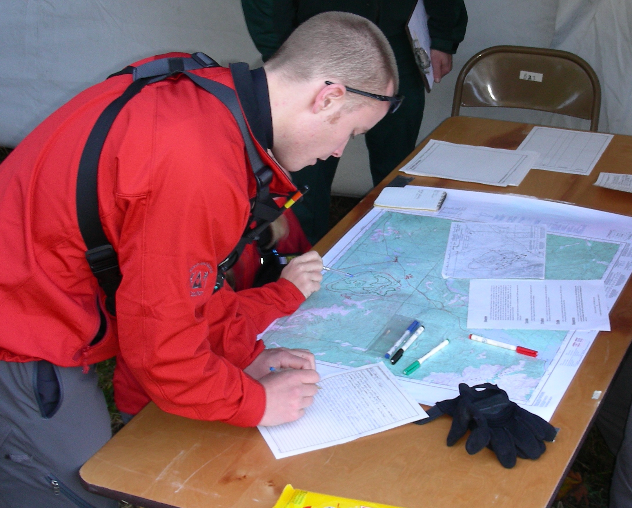
There are several issues when relaying lat/lon data by voice. The first is that saying the degrees, minutes and seconds is a lot of “verbal bandwidth”. If reading this info out over the radio this increases the possibility of an error for every number, especially if the signal is marginal, or has a lot of static. The same goes for mobile phones. It would be good, therefore, to make the data as concise and as clear as possible, both to reduce the effort to read and understand it, and to make it easy to write. I have witnessed several instances where the sender or the receiver made errors when reading or writing the coordinates, and this resulted in many hours of wasted effort for our team.
The second issue is the amount of data. For example, when using decimal degrees, it is only necessary to read 4 decimal places. This gives an accuracy to about 10 metres near the equator, and slightly higher in BC – this more than enough. If your GPS is giving you more decimal places it is probably lying to you, since most of them are never this accurate despite what they may say.
Finally, there are generally accepted best practises for transmitting data over the radio. These include ensuring that the data read out is the data received. You can read about these on-line but in summary you should read the coordinates to the receiver, reading each number one by one, and reading the decimal as either “decimal” or “point”. You can use the word “break” to indicate the break between the first coordinate and the second coordinate, or use the hemisphere designation. Once complete ask the receiver to repeat the coordinates back to you in order to check that they transcribed them properly.
For example, format 7 above would be read
“four five point four four six one north
six five point nine four eight eight west”
I know this sounds pedantic, but I’ve spent 10 years training SAR members to do this and it takes some time to get them used to it. Believe me, once you get use to this is makes reading credit cards and postal codes to someone quite easy.
Recommendations
- Use UTM whenever possible.It’s the best suited for navigation, it’s the standard for Canada, and it is the coordinate system that all ground SAR teams use.
- If you have to use lat/lon, use decimal degrees.This is the easiest to read and transcribe since it contains no special characters.
- Using decimal degrees, only read 4 decimal places.
Any more than 4 gives accuracy to a meter or less, and it is both unnecessary, and unlikely that your GPS is that accurate anyway. This makes decimal degrees the easiest to transmit. - Be sure to read each number separately for clarity.
- Read the decimal point out loud!!!
- When reading a coordinate on the radio or mobile phone, have the operator repeat it back to you.
Note
Unless absolutely necessary, and until further notice, use the datum WGS84 (NAD83 is pretty much the same thing)
Note 2
please see part 2
Great read,
Few points from a pilot perspective.
1. My portable garmin 296 has no problem using just about every possible format, given to me. Its is a bit of pain to switch the settings especially in flight but can be done.
2. Installed aviation GPS are different story. nothing is easy with them. Ours accept only two formats UTM’s and Degrees Minutes seconds. Switching between the two is a challenge. If not impossible without the Manual.
3. We seem to always use in BC, Decimal minutes. The only reason i can think of is BC forestry uses it. So my GPS stays on that format. And i suspect every other pilot does the same. Its the format i use the most.
Dont even get me started on legal land descriptions. Found in alberta and northern BC. Most common in the oil patch. Since every well site has metal sign with it stamped on
Derek
Thanks for the feedback Derek; I’ll use this for my presentation. Since SAR is always interfaceing with other agencies we have to be very adaptable to how they do things. We already switch from UTM to geographic when talking to helicopters.
I know I’m commenting on an old thread, but it is really clearly written and very helpful — thank you!
I wonder if you could clarify how to read out UTM coordinates in a rescue call. Do you have to give the Grid Zone before the actual coordinates? For example: 10U would be “one zero uniform” followed by easting/northing numbers?
Andrew
The way we’re trained here on the south coast is as followed
Field: “Stand by for coordinates”
Command: “Standing by”
Field: “easting” digits followed by the word “break” followed by the “northing” digits followed by “over”
Command: Copy “read back digits in the same format as above”
If you’re in a part of the world that’s on a UTM Zone boundary you’re definitely going to have to include the zone. I’ve never had to do this.
Thanks, Michael. Just the sort of answer I was looking for. It’s useful to hear the communication protocol SAR folk are using.